Penang Hill Map - Bukit Bendara
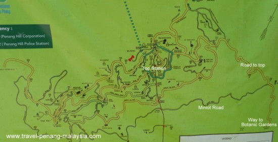
This Penang Hill map (Bukit Bendera map) shows you all the roads and pathways around Penang Hill.
If you are walking up the hill from the Botanical Gardens you follow the road on the right of the first map.
If you want to follow the old Miniot Road that branches off from this road, you can see by this map that it is a much longer route going all the way around the front of the hill.
Please visit our Walking Up Penang Hill page if you plan to walk up the hill from the Botanical Gardens.
Penang Hill Map :

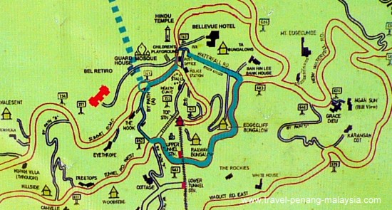
 map of top Penang Hill
The above map of Penang Hill shows just the very top of the hill with the Penang Hill Train top station in the middle of the map.
The top of Penang Hill is fairly flat so you can easily walk around this area without too much effort.
For more information on how to travel up Penang Hill by train with ticket prices and operating times :
Another good place to visit in Ayer Itam, fairly close to the train up to the top of the hill is the large Kek Lok Si Temple complex.
This is Penang's largest Temple, so give yourself at least an hour or two to wander around the grounds- you can see it from the hill.
Related Pages on our Site :
About Penang Hill main page >>
Penang Hill Funicular Railway Information >>
